Water Canyon and Timber Canyon Trails

A view toward the rim of Water Canyon and toward Timber Canyon.
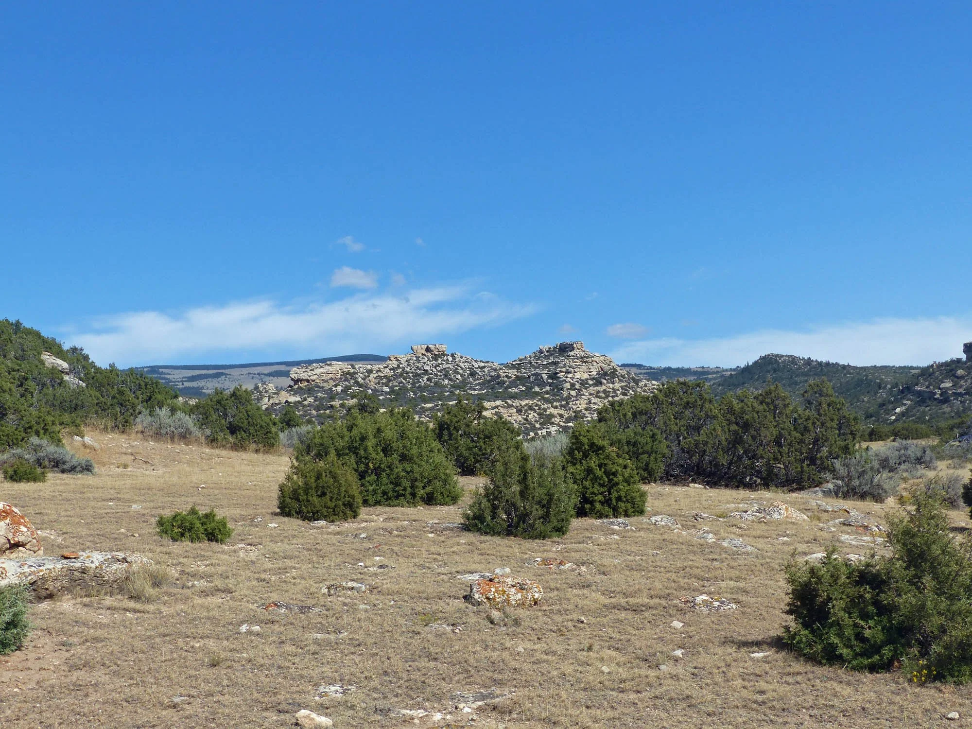
View west from Timber Canyon Ridge. (d. walton photos)

View over Water Canyon and the plains of Wyoming.

An arch on a high ridge visible from the Water Canyon Trailhead.

Rita climbing out of Water Canyon toward Timber Canyon Ridge.

View from near Water Canyon trailhead
Download Printable version of Water Canyon and Timber Canyon Trails Guide. Update (not yet in print version): The “landmark” antique farm machinery is gone.)
Both Timber Canyon and Water Canyon provide quiet foot-trails on BLM managed land on the west slope of Big Pryor Mountain. Each trail is an interesting out-and-back hike which can be extended onto USFS managed land. The longer Timber Canyon Trail allows secluded hiking or horseback riding far up Big Pryor mountain. Connected by a challenging, short and steep off-trail segment, the two trails provide a great loop-hike opportunity. This connection is not suitable for horse travel.
The 2021 BLM Travel Management Plan for the Pryors designates Timber Canyon Trail for “non-mechanized” use only. That means the trail is both motor-free and wheel-free (i.e. no ATVs, mountain bikes, or e-bikes). Presumably when BLM implements the new Travel Plan the Timber Canyon Trail will be signed and indicated on maps distributed to the public.
The 2021 Travel Plan designates Water Canyon Trail for Administrative use only. That means BLM staff may access the area with motor vehicles. Such motorized administrative use will probably be very infrequent. Public use with motorized or mechanized (e.g. bikes) vehicles is not permitted. Foot-travel (human and horse) is explicitly permitted, but inexplicably BLM will not publicize or map the trail for public use.
Getting There: Driving Directions*:
Detailed Maps and Driving Directions to Pryor Mountain hiking trailheads are available on the Hiking Overview page.
From Bridger MT:
Drive 2.5 miles south of Bridger on Highway 310 to Pryor Mountain Road (PMR). (This is 0.5 mile south of the bridge over the Clarks Fork of the Yellowstone River.)
Turn east on PMR.
Follow PMR 12.2 miles to a “T” junction. PMR is paved for 2.0 miles to a railroad crossing. Then it is good gravel to the “T” junction.
Turn south (right) at “T” junction. (This is opposite the turn to the PMR and Crooked Creek Trailheads.)
Drive south 1.5 miles to a right angle left turn, then east 1.3 miles to a “T” junction at Railbed Rd.
Turn south (right) on S Railbed Rd. Ignore the “National Forest Access” sign with an arrow to the left.
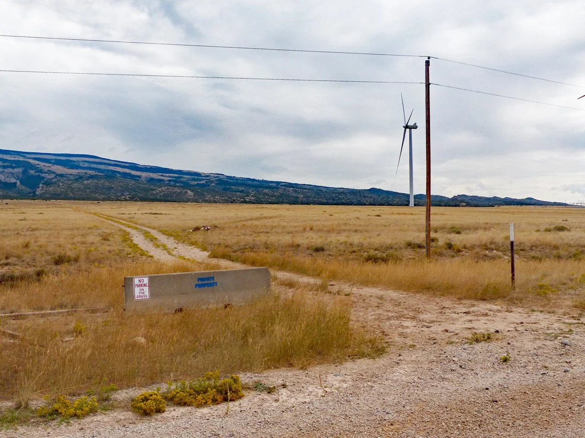
Drive 1.0 mile south on S Railbed Rd. to an obscure and unsigned two-track road to the left (east) just before (north of) a prominent ranch road to the right. (See photo) Note: Just before this two-track there is an interesting piece of antique farm machinery in the field on the right, (Update: as of 8/29/2025 this antique was gone.)
Turn left (east) on the two-track, then immediately turn right at the two-track “Y”. (See photo.)
Warning: On Google Earth and Google Maps many different roads on or near the west slope of Big Pryor Mountain are erroneously labeled as “Pryor Mountain Rd.”, “Railroad Gr. Rd.”, or “Miller Rd.”

Signs at “T” junction on Railbed Road. Looking east.

Looking west from Railbed Rd. The easily missed access troad is east of Railbed Rd opposite this ranch house.

Unsigned and unnamed two-track access route and “Y” east from S Railbed Rd. This track, and especially the fork, can be quite obscure when the grass is tall.

The two-track approaches this wind farm "industrial" site, then turns left to pass to the east.
Follow this two-track access road for 1.7 miles from S Railbed Rd until it curves into the mouth of Timber Canyon, and shortly to a “Timber Canyon Route 1049” sign. (See map and photo below.) This is the start of the Timber Canyon hiking trail. Parts of the Access Road cross private property. Please respect the owner’s property.

Google Earth Map of Trailhead access.
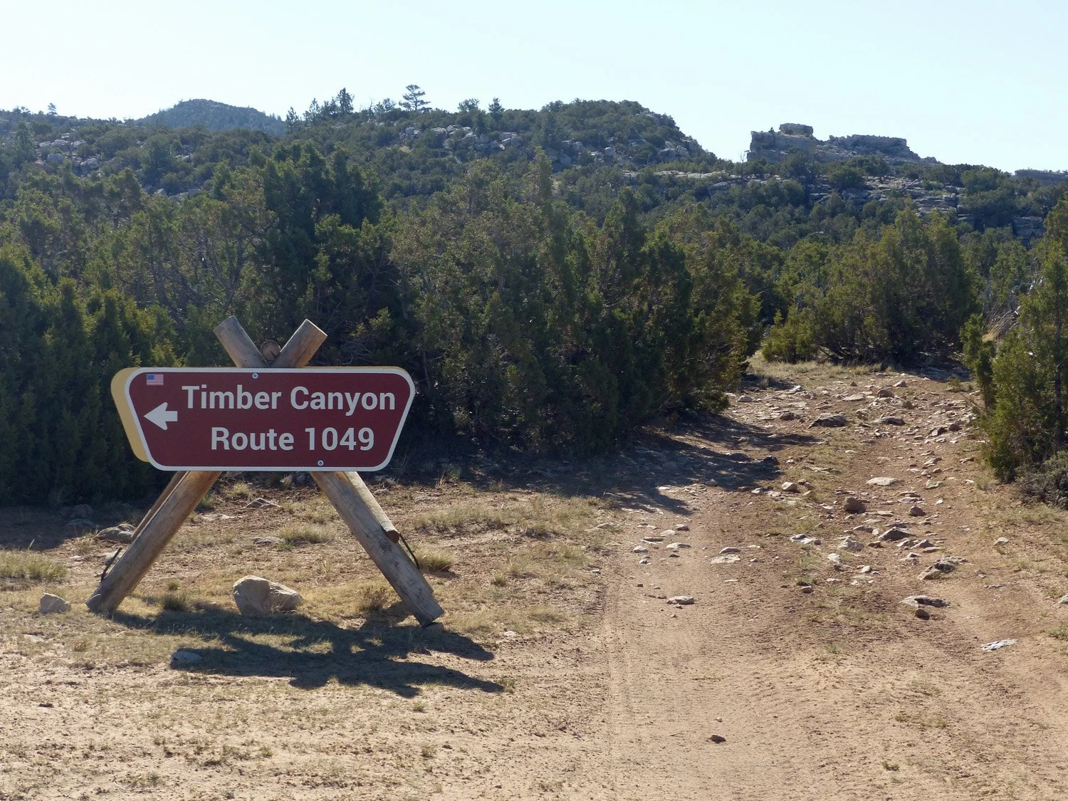
Sign at mouth of Timber Canyon. The road straight ahead continues south 0.5 mile to Water Canyon.

0.3 Mile Junction: Timber Canyon Trail right; Motor Route #1049 left
Google Earth view of beginning of Timber Canyon Trail.
Timber Canyon Trail:
Park near the Timber Canyon sign (4,950 feet elevation) and start walking. Unfortunately the first 0.3 miles is open to public motorized use in the new 2021 Travel Plan. (Officially it was not open previously, but was used nevertheless.) At 0.3 miles there is a fork in the trail. (See photo.) The left fork (1049) is a “new” motorized route. The unsigned right fork is the Timber Canyon foot-trail.
Timber Canyon Trail continues northeast for about a mile to the BLM/USFS boundary fence and gate. The two-track continues on the USFS managed land, but is not officially designated for any use. Nevertheless foot-travel only (human and horse) is permitted. The track is no longer in the canyon. It follows a wide and open ridge south of, and paralleling, Timber Canyon. (Water Canyon is roughly parallel farther south.) The two-track soon fades to invisibility on the USFS land, but remnants of the track most of the way to Stockman Trail can be seen on Google Earth. Apparently illegal use is now very infrequent. Wander northeast paralleling Timber Canyon rim as far as you wish. The ridge is easy (uphill) walking for a little over two miles from the USFS boundary to motor-legal Stockman Trail at about 7,600 feet elevation.

Google Earth view of Water and Timber Canyon Trails. CLICK to ENLARGE.

The fence and gate 0.3 miles south of Timber Canyon - looking north.

Beginning of the Water Canyon Trail. Apparently the gatepost on the right marks the BLM boundary. The foreground is private land. Park inside. Do not drive farther. (Water Canyon is designated for administrative motorized use, but that will probably be infrequent.)
Water Canyon:
Getting There:
Follow the two-track access road south 0.3 miles from Timber Canyon to a fence and gate (See photo), then another about 0.2 miles to the mouth of Water Canyon and Trail 1051. (See photo.) Since it is only about ½ mile between the Timber Canyon and Water Canyon trailheads, a car shuttle is not necessary to combine them into a loop hike.
Water Canyon Trail:
The two-track trail follows the bottom of Water Canyon valley for 1.1 miles to the BLM/USFS boundary fence. The canyon narrows with increasing rock cliffs on the sides, and several smaller side canyons. About 0.4 miles from the USFS boundary the track enters the dry “stream” channel for another 0.1 mile. Beyond that hikers can explore on their own.
Water Canyon - Timber Canyon Loop Hike:
See map above. The loop is about a 7 mile hike including the half-mile walk on the access road back to the car. Total elevation gain is about 2,000 feet to 6,800 feet elevation. (All dependent on exact route chosen.)
Start with the ~1.6 mile Water Canyon Trail as described above. The main challenge is to find a route from the bottom of Water Canyon to the north canyon rim. (We do not claim the route shown on the map is the “best” way.) Continue up the canyon bottom partly off-trail for maybe a mile beyond the BLM/USFS boundary fence. Watch for a route through the cliffs above on the left (north). It will be steep, and include some scrambling on loose rocks near the top, but no rock climbing should be required. It is about 300 feet elevation climb to the rim.
Once on top hikers have free-run of the plateau between Water and Timber Canyons. We suggest heading roughly northeast following the rim of Water Canyon and then the prominent side canyon. (See GE map.) This will avoid ups and downs crossing the several small drainages within the plateau.
After passing the heads of the small drainages, head north toward the south rim of Timber Canyon. This will be about one mile, and 800 feet elevation gain from first reaching the rim of Water Canyon. (It is about another mile northeast, and another 800 feet elevation gain up to (motor-legal) Stockman Trail.)
A fairly clear remnant two-track east of the boundary fence. Looking east. (2018 photo.)
The north-south USFS/BLM boundary fence and gate. Looking northeast from BLM into USFS and Timber Canyon beyond. (2018 photo.)
Finding Timber Canyon Trail:
In order to complete the loop it is necessary to find the top end of the Timber Canyon Trail. It is unlikely that there will be any sign of a hiking trail, or the faint two-track, high on the plateau. But remnants of the two-track were visible in 2013 Google Earth images for at least a mile NE of the gate.
Head southwest (downhill) near, and roughly paralleling the south rim of Timber Canyon. It is approximately 1.3 miles and 800 feet elevation drop to the USFS/BLM boundary fence on the yellow track shown on the GE map. Closer to that boundary fence faint remnants of the old two-track may become more obvious. (Hopefully there will be no more illegal motorized travel here.)
Likely the Timber Canyon Trail will be visible before getting to the boundary fence. But to be sure, stay in sight of the Timber Canyon rim on your right. The trail and gate in the N-S fence is about 100 yards south from the rim. From the fence and gate down to the trailhead, the trail is obvious…
Except: See the GE Map of the beginning of Timber Canyon Trail and notes above to avoid missing the sharp right turn across the shallow gulley near the end.